Goldfields Getaway
30 March, 2021
Betley and Eddington driving tour
Having previously toured from Dunolly out through the Bromley/Burnt Creek area, it was obvious that at some time we needed to look at what was happening to the areas of Betley and Eddington. There was a contrast in these two areas compared to the...
Having previously touredfrom Dunolly out through the Bromley/Burnt Creek area, it was obvious that at some time we neededto look at what was happening tothe areas of Betley and Eddington.
There was a contrast in these two areas compared to the Dunolly and Burnt Creek heavy gold mining area. There was nothing like the 100,000 minersand other persons involved but a less tense and more considered set of happenings.
With this in mind I set off for Eddington along a road that was not in existence when Burnt Creek Village was established. However it was noted that 5km out is the Wild Dog Road and down this road is located another smaller but profitable area for mining. Little is left of the town – only one building believed to be a butcher shop.
Continuing on down the road you pass, on the left, the gun club entry and then at the 10km markyou will cross the Bet Bet Creek.
Continue straight ahead down past the right hand bend in the main road and you are now in Eddington. Half a kilometre later the golf club is on the right and years ago the second racecourse was between the golf club and the centre of town.
Soon turn left into Owen Street (at the 12.3km mark). If the old street – Hector Street – was stillin existence it was at the 12km mark along a fence. Hector Street ran down to the Loddon River andcrossed a bridge – this was later burnt by some officials.
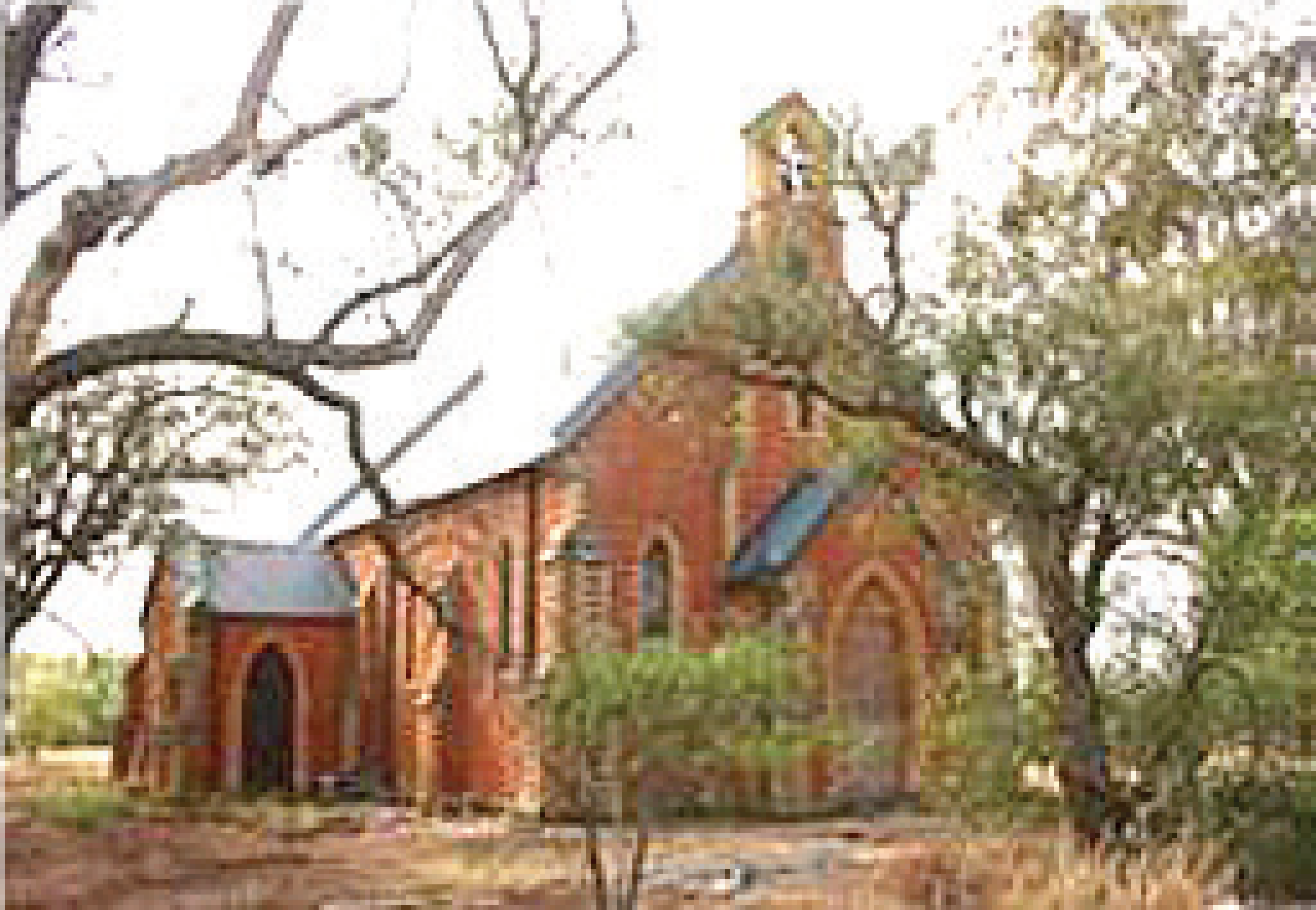
In Hector Street was a boot repairer, produce store, cheese factory, and down on the flat, the first race track. Owen Street has afew remaining buildings with theAnglican Church on the right handcorner with Murchison Street.
On the left before the first of two homes would be the site ofthe original Methodist Church–unfortunately burnt down. As youturn right into Murchison Streetlook down onto the river flats –Sheehan’s Flour Mill was locatedbetween the road and river. In thisshort section you would have had,before the magnificent privatehome on the left, the butcher shopof Gill and on the right the saleyards.
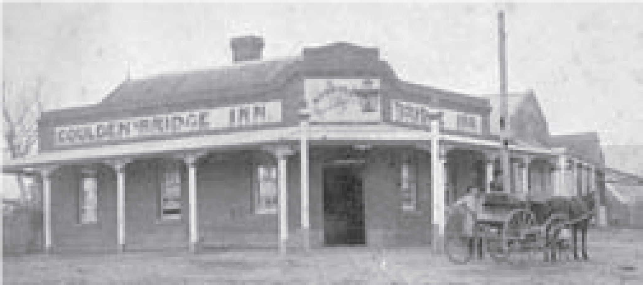
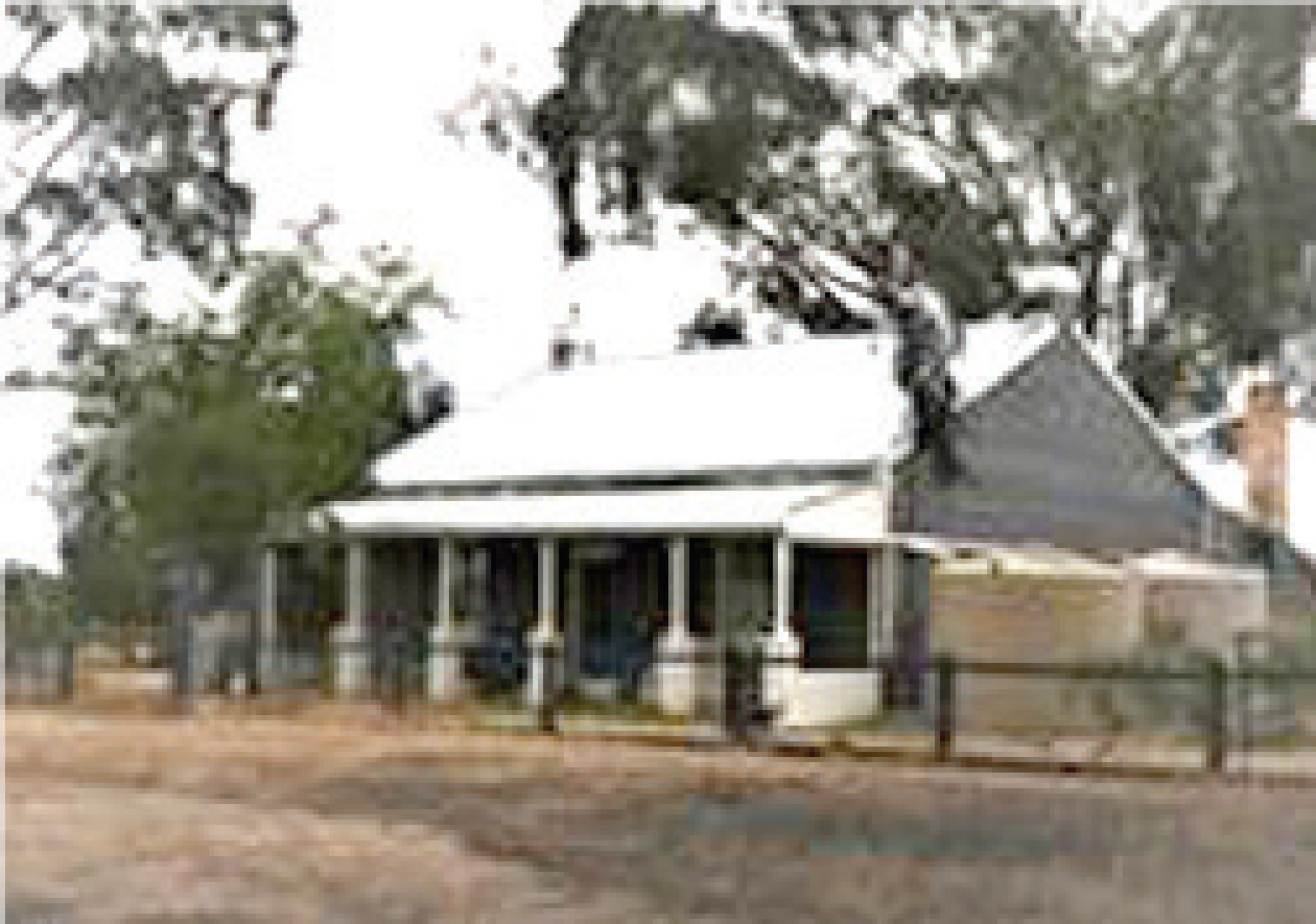
At the corner there is a bit to take in for we have the well marked entry to the original bridge. It is well worth taking theshort walk down to the river(note all the pumps for river watersupply and the stumps of thepylons in the water). Across theriver was the Farmers Arms Hoteland other businesses. At thecorner, where you parked, it isfortunate that the building thatwas once the Goulden Bridge Innstill stands.
At this point we need aconsiderable amount ofimagination as there is so little ofthe original buildings remaining onthe left hand side ofMcCoy Street, as you goup the hill. It may also bebetter if you walk up thehill and back down the other side as there aresome history labels toread.
Listing from the Inn there would have been Mayo’s Store, CommercialHotel, Police Barracks (stillon site are buildings downTaylors Lane), Kilgour’s Saddlery,Mr Jackson’s Pharmacy and thePrimitive Methodist Church.
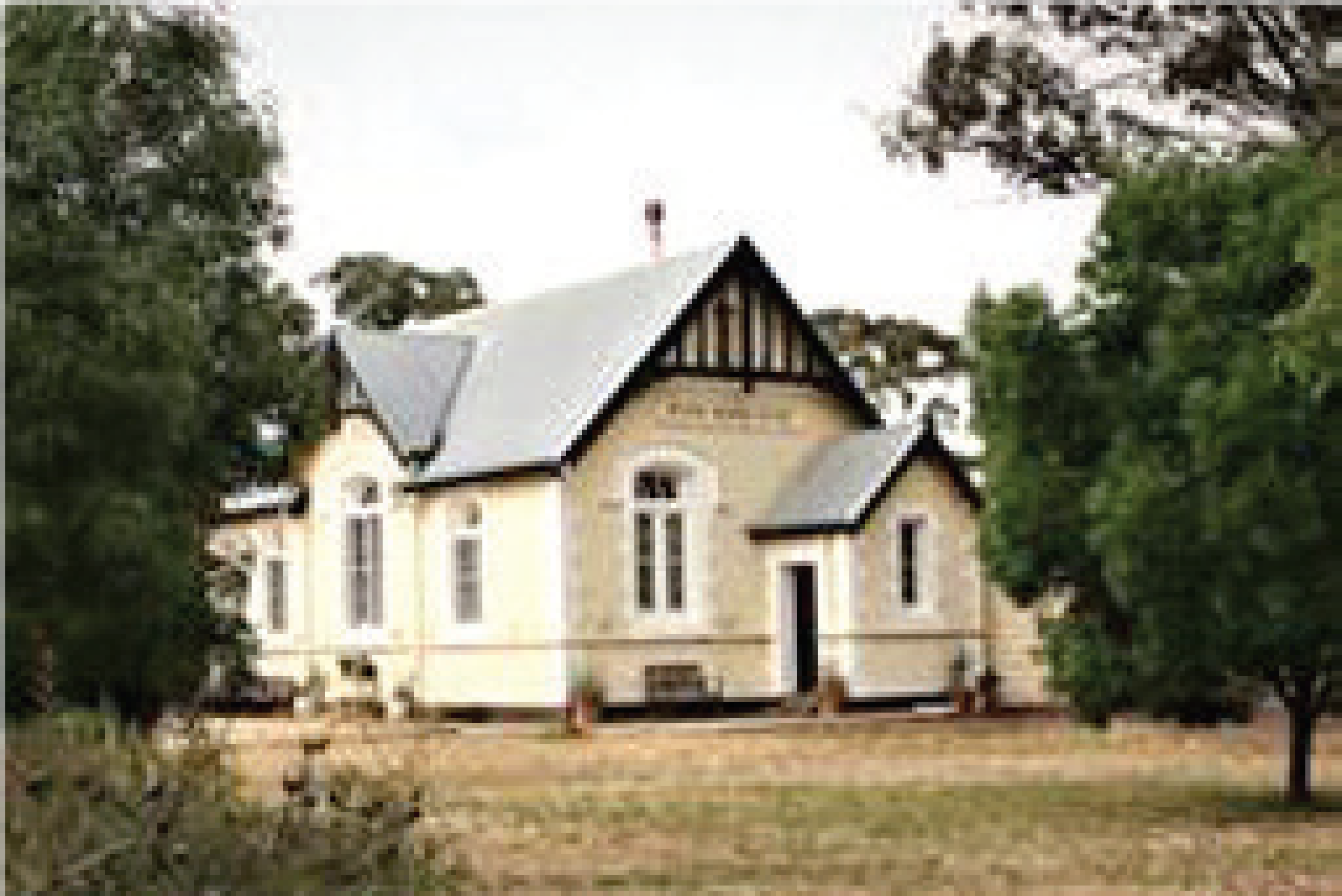
At the top corner take a leftdown to some concrete posts andat the near end are old wroughtiron gates. This site was that of theoriginal Roman Catholic Church,which sadly burnt down. Acrossthe road you will note the originalschool building (now a privatehome).
Back to the corner and crossover to the information board andthe recreational centre. This wasthe sight of the Mechanics Institute. Read the board and youmay note a few differences in thefacts to what is listed there.
Further to the left is a newinnovation in a model railway.
Now to return to your car viathe left hand side, going down-hill.
On the first corner is the original Presbyterian Church (recentlysold).
Next was the home of a Mr Pittman, a music teacher, then asmall post office (the PO hadmany positions over time). Thenext building exists and it wasWillersdorf and Forbes Office(most likely Stock and Stationagents), an extremely small bank ofCBC.
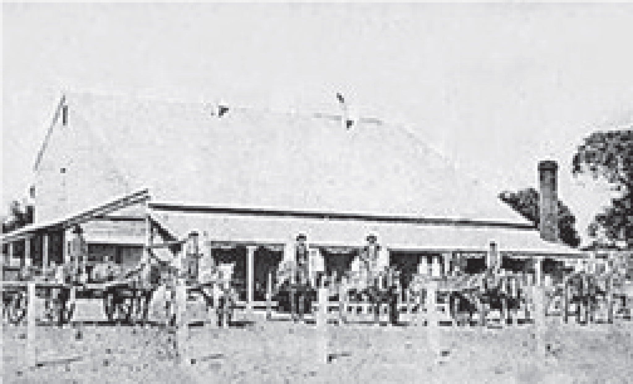
Then follows John Moore’sBlacksmith establishment (one of two positions as position oneburnt down), Willersdorf’s GeneralStore (still standing), EddingtonHotel (still standing), open smallpaddock (possible first blacksmithposition), then on the raised humpbefore the corner was thesaddlers shack.
Note the left hand building in the picture on the right hand side of thepage is the blacksmith shop, with thecurrent two shops on its right, with verandas.
At this point you might like totravel down Playfair Street and return to the school corner andtake a left out to the main road.
Turn left and travel down to the river crossing bridge (circa 1926).
Just before crossing the bridge you will note Morrisons Engineeringon the left and Freemantle’sprevious Chaff Mill, now leased forfarming purposes.
Crossing the bridge and on your right is another historicproperty followed by the cemetery. You may wish to lookabout the area a bit more.
We now continue the tour by returning back over the bridge andfollowing the main road for four kilometres,noting farms on the right with a strong history in crop and cattlebreeding. Note the winery onyour left.
Now watch for the next right turnand also watch for oncoming traffic.This is a bad corner.
Turn right down toward Betley.
Immediately look to your distant right to see Mt Moliagul and MtBealiba. To your left, and ahead,begins the fertile flatter country that was very productive in yearsgone by with vineyards, orchardsand cropping. There were alsodairies. Remember the cheesefactory mentioned in Eddington?
On your right is a substantialhorse stud called Stonehouse.
Next is Freemantle Lane and to your right and left is evidence ofserious mining – Burnt CreekNumber 2 Mine is the label for thearea to your left – now a quarry.
Enjoy the drive up to the crossroads which is the nextjunction.
The area around Betley wasfertile with the alluvial soilsbetween the Bet Bet and BurntCreeks. And so it was the settlersin this area that saw orchards andvineyards created and flourish. Anumber of farmers saw smallholdings grow sheep, chickens anddairy cattle. Starting small somesaw growth and takeovers
occurred.
The Peart family were moreadventurous with theestablishment of a pig enterprisethat was very successful. Many ofthe farmers produced largequantities of fruit and vegetablesto be self-sufficient and sold theexcess to surrounding markets.The export produce usually wentto the Bet Bet Station fortransportation.
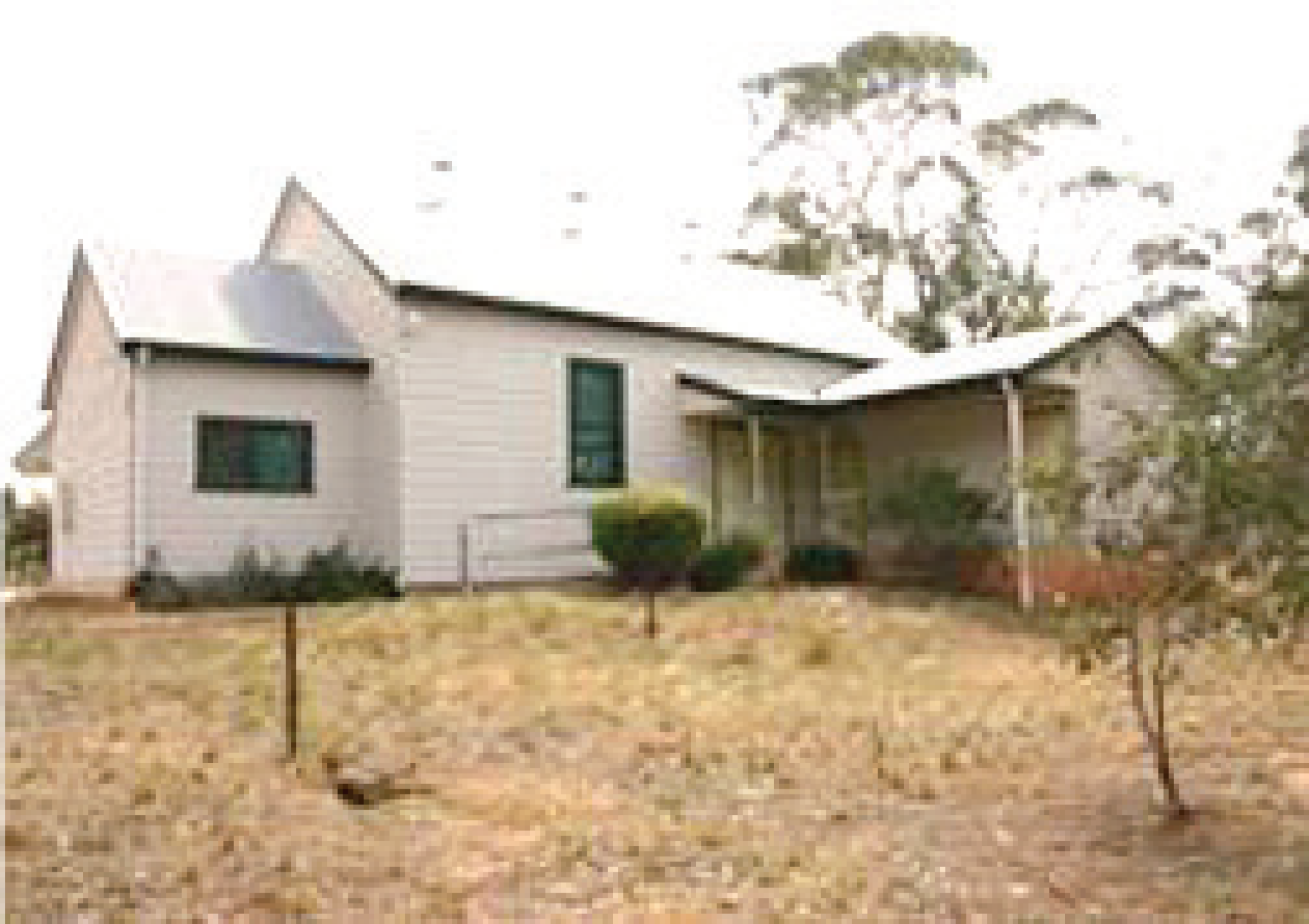
Betley was an outpost ofDunolly but it still provided thearea with a post office, store,school, hall and a church on thenorth side of the creek.
The south side of the creek andbridge was the business side withtwo grocery/merchandise stores,four boarding houses, two billiardsaloons, drapers shop, twoblacksmiths, wine shanties, and abakery. The main farmingproperties were all self-sufficientand most had cellars and wells.
Most of the mining in Betley was between 1880 and 1920 andwithin five major mines – Consol’s,Sweet Nell, Good Hope Mine,Burnt Creek No. 1 and BurntCreek No. 2. 1500 miners worked in the area and hence boardinghouses were in demand. The miners also built shanties andshacks on sites but generally there was not the hustle and bustle of the Dunolly area. The timber tofire the boilers came mostly fromWaanyarra Forest.Today the bridge is still thedefining point and the hall andschool buildings are on the northside. Upstream you will find asluice and there are still a few ofthe original main properties intactbut most have gone and newplaces have become the presentsights to be seen.
Miners who worked in themines could have been at theirown mines, maybe in Burnt Creekor Dunolly, and not necessarilyneeding accommodation in Betley.
Not all miners, working down the pits, lived locally, or maybetravelled quite a distance, due tothe pressure on accommodation.
There were a number of boardinghouses along the Dunolly Road aswell as in the town.
So what can we see in Betleyfrom the past?
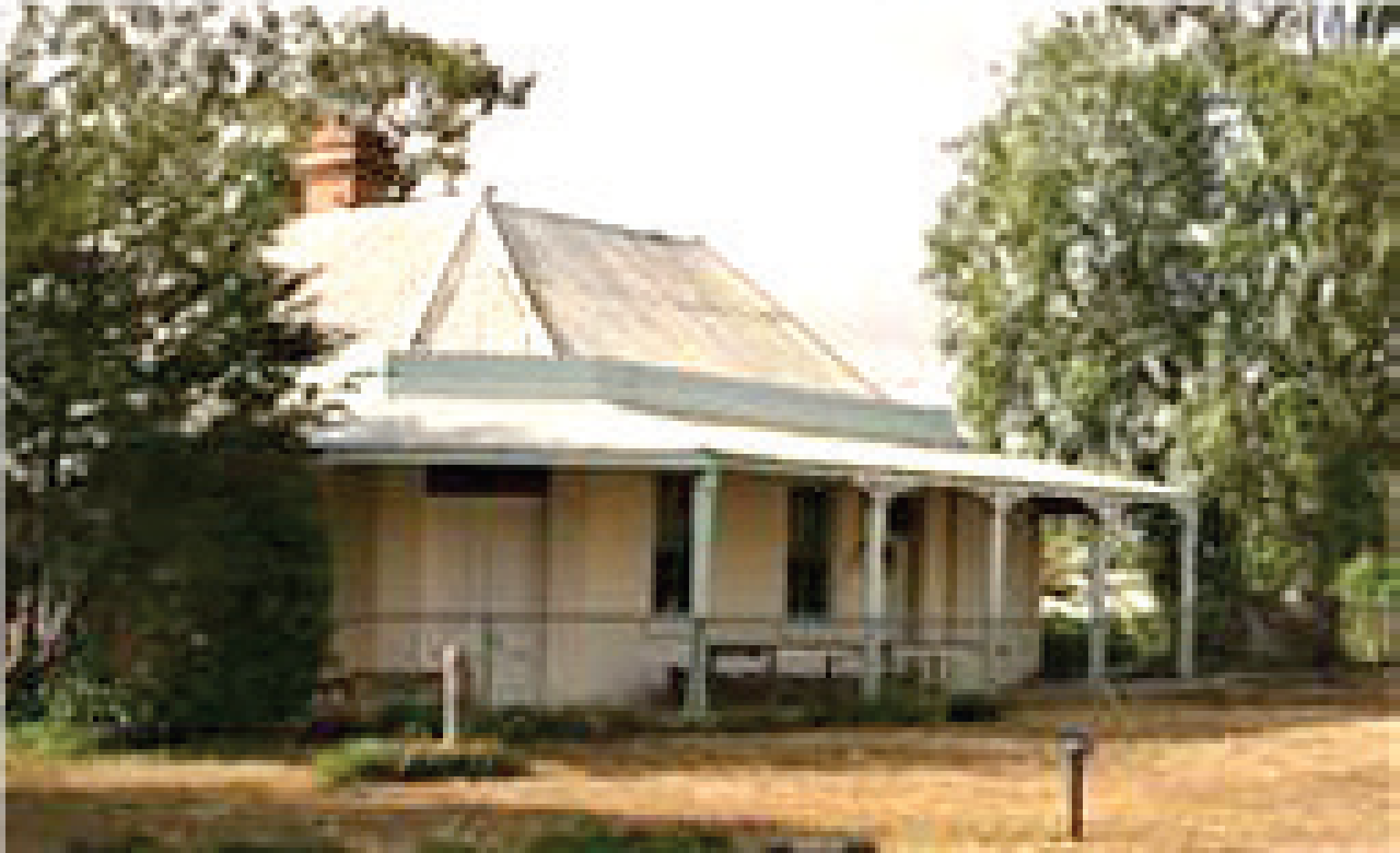
From the crossroads you canview a flattened mine heap up theMaryborough-Betley Road in thefar right hand corner of Bet BetRoad. This was the location ofConsol Mine. Return to the roadjunction and turn, crossing thebridge and noting the hall, which isstill in use. If you turn right to goup to the hall you will note the school site on your left, now notonly a new school but a convertedschool made into a lovely modernhome.
The hall – the MechanicsInstitute Hall – has been manythings and has had a few faceliftsbut has served the communityvery well. One of its roleswas tohold Church of England servicesfrom around 1890 and have alibrary there plus all thosefunctions.
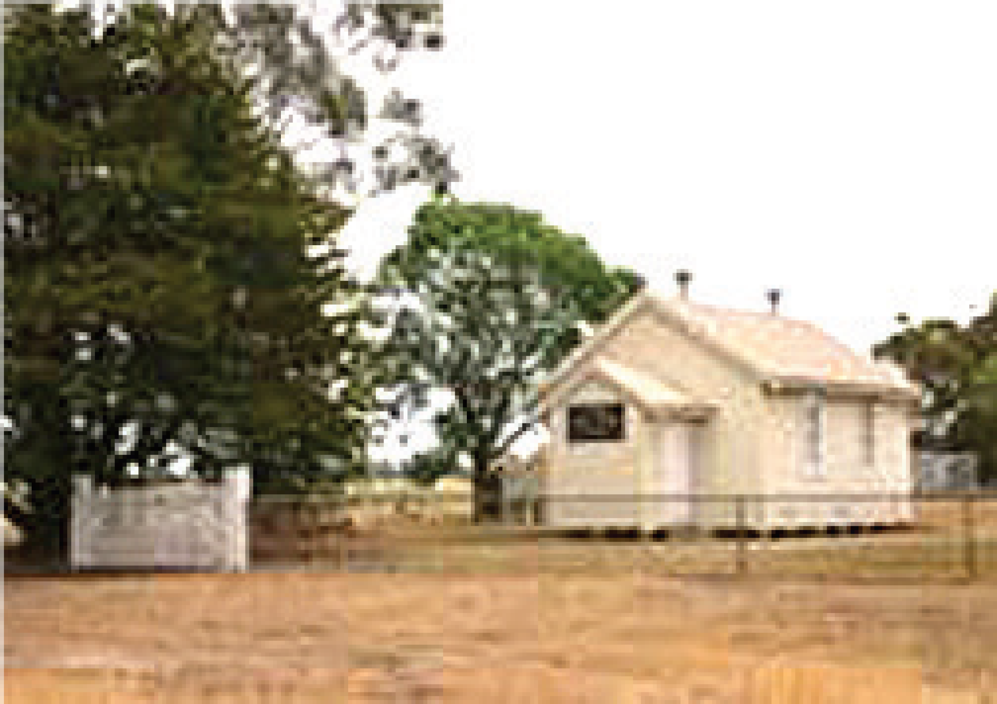
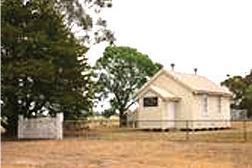
Back to the Dunolly Road andturn right and soon you will seethe original church, now labelledUniting but originally wasnondenominational and later wassaid to be Presbyterian.
The first building was larger andbuilt in 1908, but due to a whiteant infestation it was demolishedand rebuilt small as it is today.
Most of the housing that existed inthe streets behind the church hasgone and the house on the nextcorner of Howard Street was theoriginal house of the Howardfamily.
Passing Howard Street, if youstop and look to the right acrossthe paddocks you will see the pileof rubble left by the Burnt CreekNo. 1 Mine.
Now there are a few relics leftin paddocks but the next propertybelongs to the Peart family – theproperty that had the advancedpiggery mentioned earlier.
Moving on we come to theremnants of the Sweet Nell Mineon your left and the original Peartfamily home is on your right.
It is now less than a kilometreto the end of Betley and the startof Bromley where we leftthe winter tour earlierthis year. To end this tourwe see Cavalier Pinesproperty. It is said thatthis was the property of amine manager in earlierdays.
It is hoped that sometime in the future I will beable to view the miningsluice and get morepictures. It is exciting todiscover little gems alongthe way but the search is the bestpart.
I acknowledge the assistance of the Eddington community and theassistance of the Peart family atBetley for providing material andassistance.
I have provided most of the photographs.